
Agriculture has always been an essential part of India’s economy. According to the International Labour Organization, in 2022, around 43% of the country’s labor force were involved in agriculture. It is also one of the largest livelihood providers in India.
Historically, the agriculture sector’s productivity has been challenged by small landholdings, fragmented plots, uncertain weather patterns, and restricted access to technology. The Green Revolution, which occurred in the 1960s, resulted in notable advancements through the implementation of high-yielding variety seeds, fertilizers, and irrigation projects.
Despite the large agricultural sector in the country, it only contributes about 15% to the country’s gross domestic product (GDP). Productivity fluctuates, and the earnings of farmers are highly susceptible to even the slightest changes in weather or market conditions.
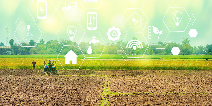
Utilizing Technology to Increase Productivity
A Reuters report revealed that the Earth-observation satellites have helped improve farm yields in India’s agriculture. Satellite technology, which was formerly limited to military and space exploration, is now being deployed to address some of the common agricultural challenges. Satellites are able to provide farmers with precise, up-to-date, and reliable data, allowing them to gain a fresh perspective on their fields and effectively oversee their management. This data-driven approach is also commonly referred to as ‘smart farming.’
Satellites, which are usually equipped with advanced sensors, are able to capture photos and collect data throughout a wide spectrum of wavelengths, encompassing visible light, infrared radiation, and microwaves. These photos provide crucial data on soil quality, crop status, water accessibility, and pest outbreaks. When integrated with algorithms and analytics, this data may be converted into practical insights, helping farmers to make well-informed decisions.
Precision agriculture is one of the most notable uses of satellite data in Indian farming. This enables farmers to customize their practices according to the individual conditions of their fields, thereby optimizing inputs and maximizing harvests. Moreover, the Ministry of Agriculture and Farmers Welfare has launched the FASAL (Forecasting Agricultural output using Space, Agrometeorological and Land based observations) initiative.
Telecom Review Asia Pacific Exclusive Insights: IoT and Telecom Networks Drive Modernization in India’s Agriculture
FASAL relies on remote sensing data, including optical and microwave data, to accurately determine the size of agricultural areas, analyze their condition, and forecast production. The model utilizes temporal remote sensing data to monitor crops during each step of their growth. Vegetation indices, obtained from satellite observations, and weather data are essential for the development of a reliable crop growth monitoring system.
Indian startups are also taking part in advancing the use of technology in the agricultural sector in the country. For example, Cropin—an agritech business based in Bengaluru—specializes in analyzing satellite data. The company collects extensive data from earth-observation satellites, employs advanced algorithms to analyze it, and provides practical insights to farmers, including ideal sowing periods, meteorological forecasts, irrigation timetables, and suggestions for pesticide application.
In 2019, Cropin partnered with World Bank and the Indian government to successfully digitize more than 30,000 agricultural plots across 244 communities. A study revealed that 92% of the farmers participating in the research achieved a 30% rise in their average crop production, leading to a substantial boost of over 37% in their overall farm income.
Read More: How APAC Countries Are Gearing up for Agriculture 4.0
Future of Agritech
Given the growth in India’s agritech sector, the government has acknowledged the immense potential of satellite data in transforming the agricultural sector and is making substantial investments to further improve this initiative.
According to Market Research Future, the worldwide space agriculture industry is projected to reach USD 11.51 billion by 2032, up from USD 4.99 billion in 2023. Additionally, India has the highest growth rate in the Asia Pacific region.
Utilizing satellite data has proven to be beneficial to Indian farmers. However, in order to make the most of the advantages of satellite data, farmers should have both access to, and comprehension of, this technology. The government should implement measures addressing the gap between advanced data technology and traditional farming methods. Moreover, education, training, and the creation of user-friendly tools can be deployed to solve this issue through various programs.
Digital Green, a global development organization, has taken the initiative to assist farmers with this new method. By utilizing satellite data and providing on-ground assistance, Digital Green has enabled numerous farmers to acquire the necessary knowledge and skills for implementing intelligent agricultural techniques.
The future of smart farming in India proves to be promising. The progress in satellite technology and the possible incorporation of artificial intelligence (AI) is expected to improve the accuracy and availability of agricultural data. Furthermore, continuous efforts to enhance rural connectivity and digital literacy will ensure that traditional farmers are able to utilize the potential of satellite data.
Read More: TASL Partners with Satellogic to Pioneer Satellite Strategy in India
Latest News: Scala and PT Telkom Indonesia Join Forces to Accelerate Agritech Innovation